One of the very first things I do whenever a potential trekker comes up to me and asks how far he or she has to hike to reach Annapurna Base Camp is to figure out where abouts the trekker will start their hike.
It is just that "ABC trek" is far from describing one unique walking route.
In case a trekker's route starts from Ghandruk, then that's different from a route that begins even farther south and possibly includes deeper road transport into the Himalayas of the Annapurna region.
When it comes to a trekkers' route in Ghandruk, one very practical planning estimate is a total walking distance of about 60 to 70 km, but I would never write that number alone on a booking form without also providing a sketch of the real hiking route.
The first segment by road has to be included in the total trek length.
Latest Travel Blogs
Ghandruk Is the Starting Point That Changes the Calculation
ABC Trek Distance and Elevation
Ghandruk reaches around 1,940 meters height.
Short itineraries to Annapurna Base Camp commonly choose this place as the beginning of the route.
By choosing this path, a significant portion of the old approach walk is eliminated as compared with itineraries from lower trailheads.
That explains why the older distance of the ABC trek and the new distance of the Ghandruk-based trek should not be considered simply two of the same thing.
When reading about a trip arrangement, try to find out whether the journey starts from "driving to Ghandruk" or even the very start of the road. Only the latter is the real beginning of the distance being measured
Chhomrong is a hamlet sitting at about 2,170 meters. On its way to the Annapurna Sanctuary, Chhomrong is a major stopping point.
The difference in elevation is merely 230 meters between Chhomrong and Ghandruk
Yet, walking a path does not equate to walking a 230-meter ladder.
Sometimes you go up the climb, sometimes you go down the slope, then go over irregular parts of the rock, and then start climbing again.
This is the reason why I do not count the change in height from the two places of stay only, to represent the real gain in elevation.
Your body is on the trail the whole time.
Chhomrong to Bamboo: The people who come down here are the ones people forget about
Bamboo is situated at about 2,310 meters.
ABC Trek Distance and Elevation
At first sight, this seems almost level when you compare it with Chhomrong, as only about sleeping elevations vary by about 140 meters.
But it's not true.
A short time later, the trail continues downwards towards the river, then ascends again through the tree cover.
There is no clearer illustration perhaps than that of just how total climbing cannot be calculated simply by the subtraction of the starting altitude of the first day from the sleeping altitude on the second day.
The road between the two altitudes is not only important, but it is also decisive for the total elevation gained.
That makes a net gain in height of approximately 920 m.
This is a major climb in the whole ABC schedule.
At the same time, you are crossing a different altitude level.
Although the forest continues to be a part of your trail, the mountain landscape will start getting more rugged and exposed as you keep walking deeper into Modi Khola valley.
If you're an ABC hiker, this one is an elevation change that you'd better get a grip on before going to Nepal.
Deurali to Machhapuchhre Base Camp
ABC Trek Distance and Elevation
Deurali is about 3,230 meters above sea level.
Machhapuchhre Base Camp is located at about 3,700 meters.
You will be gaining an approximate elevation of 470 meters.
This part is much shorter than a complete walk, but due to the altitude variation, it is an entirely new experience.
You are already at an altitude of about 3,000 meters.
From this point onward, the way you walk, how much you rest, and how well you take to the lesser availability of oxygen are all the things that matter the most, and they can't be predicted the same way they were when you were near Ghandruk.
The last part of the climb amounts to some 430 meters.
Approximately at 3700 meters is Machhapuchhre Base Camp,
Approximately at 4130 meters is Annapurna Base Camp.
This part is estimated by various sources as 3 to 4 kilometers according to who is doing the measurement of the route.
You won't be walking very far.
But the altitude will be high.
This is the key aspect one needs to keep in mind.
Annapurna Base Camp at about 4,130 meters
ABC Trek Distance and Elevation
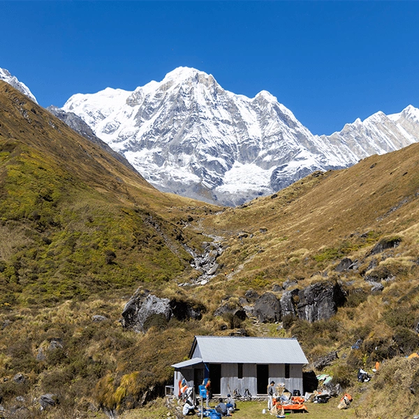
Annapurna Base Camp is located at roughly 4,130 meters within the Annapurna Sanctuary.
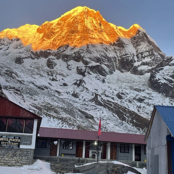
At this stage, you have transitioned from the lower green hills to the forested valleys of the lower hills and finally to a high mountain arena around the Annapurna peaks, among others including Annapurna I,Annapurna South, Hiunchuli, and Machhapuchhre.
Most importantly, the elevation gain is what gives the final approach its importance.
A trekker who only trains for 65 km of walking is missing a major part of the physical preparation.
Net elevation gain from Ghandruk to Annapurna Base Camp trek: Your start point is in the 1,900-meter range from Ghandruk, and the summit will be at approximately 4,100 meters at Annapurna Base Camp. That gives a net elevation difference of approximately 2,190 meters between the two places. Still, this is a completely different figure in a way.
This figure does not indicate your total elevation gain in the hike, as your legs might have to carry you up and down multiple times through the trail, and you might actually be climbing more than the final 2,190 meters. It's only fair that we mention this when talking about training for the trek.
Imagine the total distance of an itinerary reads 65 km.
This figure indicates how far you are going to traverse in the whole trip.
But it gives no information on the nature of those kilometres - like whether the main path is flat and walking-friendly or mainly concentrated with stairs and steep sections.
It is a fact that it doesn't say a word about the number of stone stairs you will pass.
It just leaves it to you to figure out at what height most of the kilometres will be. Do you want to walk 2,000 meters or 3,000 meters and beyond?
Transport dropping you at a spot closer to the site means fewer walking kilometres for you.
But a starting point farther away makes one have to walk more.
Even the selection of the accommodations in the valley can affect the distance walked each day.
Because of this, if one website says 60 km and another one says 80 km, you should not straight away conclude that one has it right and the other one is wrong.
Instead, check their departure points and also the layout of their routes.
In the Annapurna Base Camp Trek, I am going to distinguish between public mountain data and the data that a trekking company has control over.
Annapurna Base Camp is not a place where Holy Kailash Tours can determine the altitude.
Taking Modi Khola's geography, for instance, it remains unchangeable. The difference is that a trekking company can decide how they communicate the details of the trek.
My benchmark is quite tangible: the trek advertised to people must disclose the starting point, planned walking sections per day, sleeping heights, and transport details.
In case some of these details are not provided, the backpacker will not find enough information to rate the product fairly.
Of course, I cannot even remotely assure that every one of the trekkers will definitely cover exactly 65 km.
Honestly, making such a promise without knowing would be a complete failure of responsibility.
So rather, here is the statement that I can be absolutely honest with myself: I promise that:
Anyone who wants to compare the Holy Kailash ToursABC package can see the structure of the trail in detail BEFORE making bookings, instead of having to base the decision on just one figure: how many kms altogether?
Now that is the type of factor a tour operator can really handle.