Arrival in Kathmandu: Gateway to the Himalayas
Most Everes Base Camp treks start with a flight into Tribhuvan International Airport in Kathmandu. The city is loud, dusty, and a little chaotic compared to the quiet trails waiting ahead, but it's also where the practical groundwork for the trek gets done.
You'll need a TIMS (Trekkers' Information Management System) card and a Sagarmatha National Park entry permit. Most trekking companies, including Holy Kailash Tours, manage these permits as part of the package, which saves a lot of standing in line at government offices when you'd rather be resting before the flight to Lukla.
Plan for at least one full day in Kathmandu before heading to the mountains. Use it to:
- Check your gear against a packing list and pick up anything you forgot
- Get your permits and trekking documents sorted
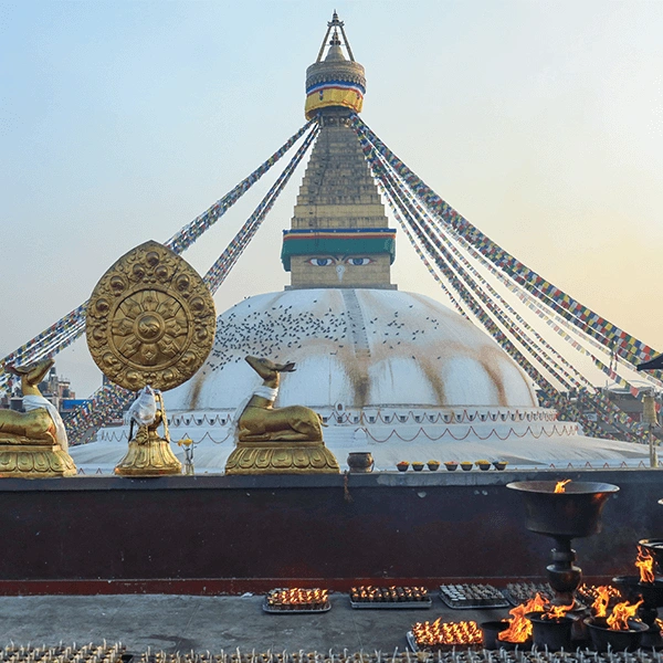
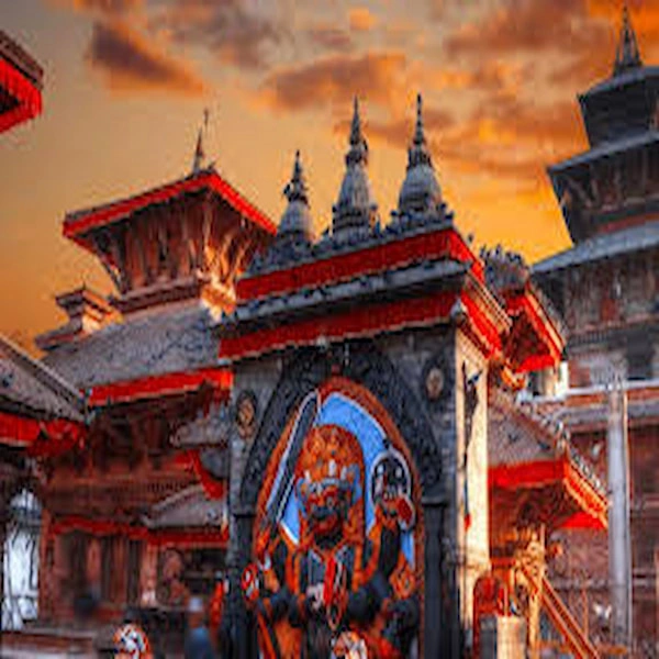
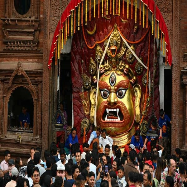
- Visit Boudhanath Stupa or Pashupatinath Temple if you have time
- Rest and adjust to the time zone, especially if you've flown a long way
Kathmandu's Thamel town is the easiest place to rent or buy last-minute gear. Down jackets, trekking poles, sleeping bags, you can find all of it here, often at a fraction of what it costs back home. Even experienced hikers use this stop to double-check their kit before flying into the mountains, where shops are scarce, and prices climb fast.
The Lukla Flight: A Thrilling Start to Your Adventure
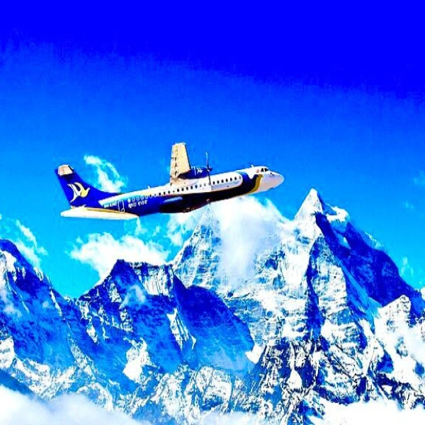
The flight from Kathmandu to Lukla is short, usually around 30 minutes, but it's one of the more memorable parts of the whole trip. You fly low over green hills that turn into jagged peaks, and the descent into Tenzing-Hillary Airport is steep and fast. The runway sits on a mountainside and slopes uphill, which helps planes slow down on landing and gain speed on takeoff.
Weather controls this flight more than any schedule does. Morning flights are standard because winds and clouds build up by midday, making the route too risky for small aircraft. Delays and cancellations happen often, especially during the monsoon season or in winter when fog rolls in.
A few practical points:
- Book morning flights whenever possible, since afternoon slots get cancelled more often
- Build a buffer day or two into your schedule in case of delays
- During peak season, flights sometimes get rerouted through Manthali airport, which adds a few hours of driving from Kathmandu
Once you land in Lukla, the air already feels different. At 2,860 meters, you're higher than most mountain towns in Europe, and the peaks around you start to feel less like postcards and more like neighbours.
Trekking from Lukla to Phakding: Entering the Khumbu
The first day of walking is gentle by EBC standards, which is exactly what your body needs after the flight. From Lukla, the trail drops down through pine forest before following the Dudh Koshi river toward Phakding, a small village at around 2,610 meters.
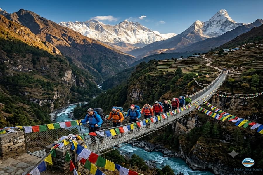
It takes about three to four hours, and most of it is downhill or flat. You'll cross your first suspension bridges here, decorated with prayer flags that snap in the wind. Mule trains and porters carrying loads that look impossibly heavy will pass you on the trail, a normal sight in this part of Nepal.
Phakding itself is a quiet riverside village with a handful of teahouses. It's a good first stop because it eases you into the rhythm of teahouse trekking: walk, arrive, rest, eat, sleep early. You'll notice right away that meals run on a simple but filling menu: dal bhat, noodle soups, momos, and basic breakfast items like porridge and eggs.
Crossing the Dudh Koshi: Walking Along the River
The trail from Phakding toward Namche Bazaar spends a good stretch following the Dudh Koshi, which translates loosely to "milk river," a name that fits its pale, glacier-fed colour.
You'll cross the river multiple times on swinging suspension bridges, some of them quite high above the water. This stretch of trail passes through small settlements like Bengkar, Monjo, and Jorsale, each with a few lodges and shops selling snacks, bottled water, and basic supplies.
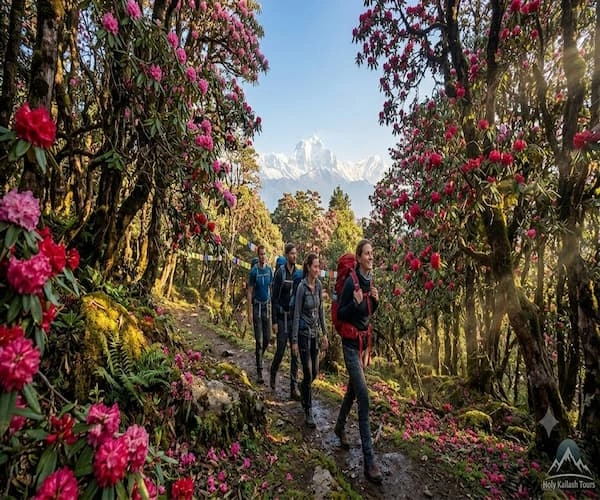
The forest here is still thick with pine and rhododendron, and you'll likely spot prayer wheels and mani stones carved with Buddhist mantras along the path. Locals walk this route daily for trade and farming, so it never feels like a tourist trail built just for trekkers. It's a working route through a living valley.
Sagarmatha National Park: Entering the Protected Zone
Just past Jorsale, the trail enters Sagarmatha National Park, where you'll need to show your park permit at the checkpoint. Sagarmatha is the Nepali name for Everest, and the park covers over 1,000 square kilometres of high Himalayan terrain.
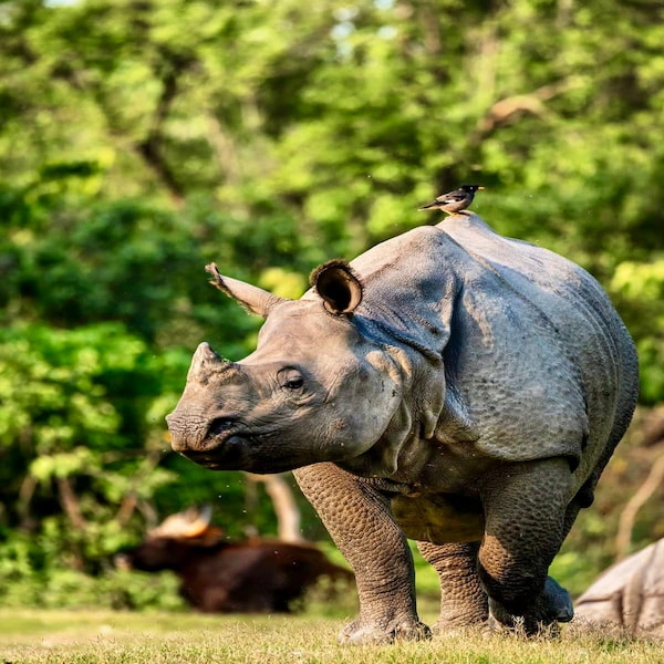
This park earned UNESCO World Heritage status in 1979 for its rare combination of extreme altitude landscapes and biodiversity. Snow leopards, Himalayan tahr, and red pandas live within its borders, though sightings are rare given how elusive these animals are.
The park also protects forests of birch, juniper, and rhododendron that thin out as you climb higher, eventually giving way to bare rock and ice above 4,000 meters. Conservation efforts here focus on managing the heavy foot traffic from trekking tourism while preserving Sherpa farming and grazing traditions that have shaped this landscape for centuries.
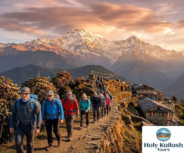
The Ascent to Namche Bazaar: The Sherpa Capital
This is the day most trekkers remember as the first real test. From Jorsale, the trail climbs steeply, gaining around 600 meters over a few hours, much of it on a switchback path carved into the hillside above the river gorge.
About halfway up, if the sky is clear, you'll get your first glimpse of Mount Everest peeking out from behind Nuptse. It's a small sliver of black rock against the sky, easy to miss if you're not looking, but it's a moment that sticks with people.
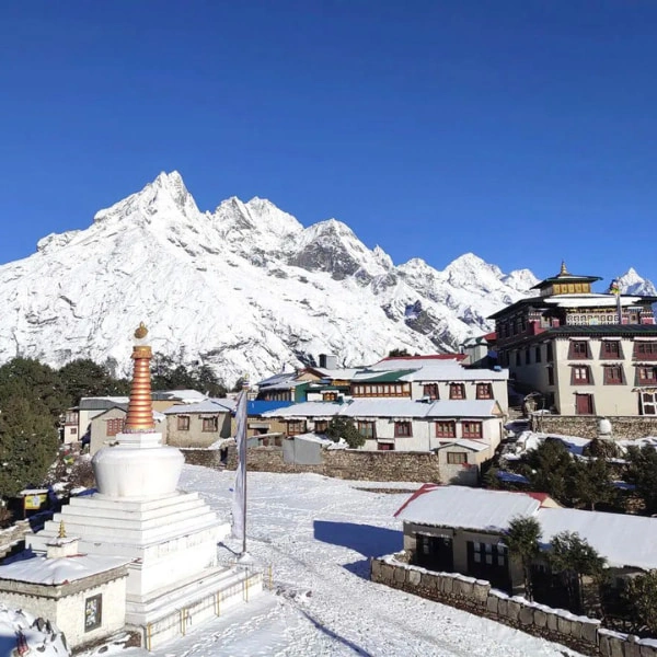
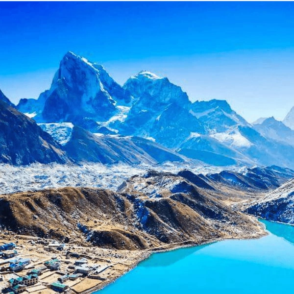
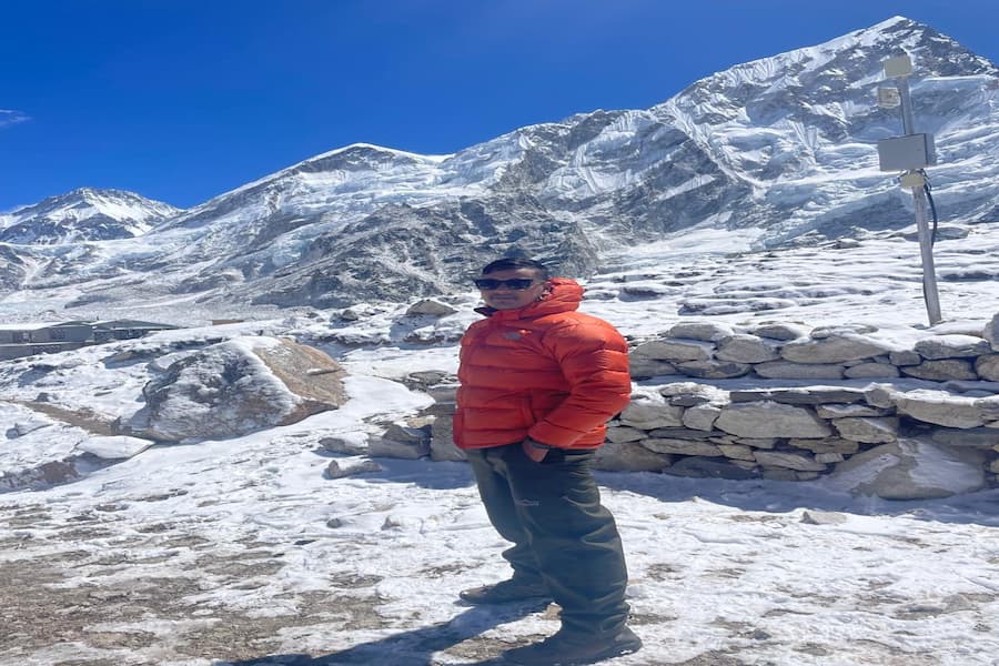
Namche Bazaar sits at 3,440 meters and is the unofficial capital of the Khumbu region. It's built into a horseshoe-shaped hillside and packed with lodges, bakeries, gear shops, and a Saturday market where locals from surrounding villages come to trade.
Namche is also where Sherpa culture really comes into focus. Many residents here have climbed Everest themselves or worked as guides on major expeditions. The town has internet cafes, ATMs, and even a few bars, which makes it the last proper "civilization" stop before the trail gets remote.
Acclimatization Day 1: Exploring Namche and Views
Most itineraries build in a rest day at Namche, and skipping it is one of the riskier shortcuts trekkers take. Acclimatization isn't about resting in bed all day. The rule that works best is "climb high, sleep low," meaning you gain altitude during the day and return to sleep at a lower point.
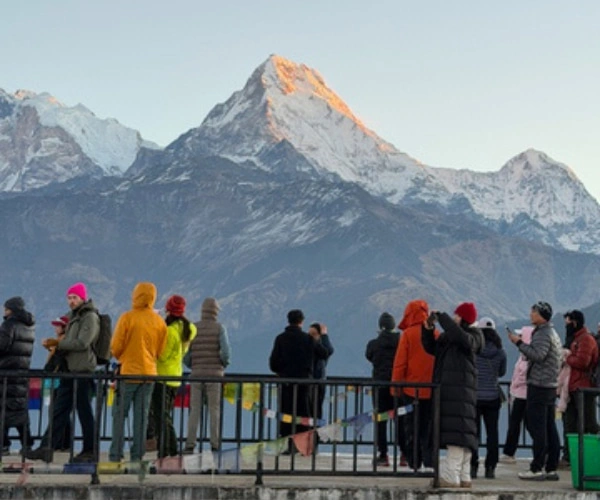
A popular option is the hike up to Everest View Hotel, sitting at around 3,880 meters. It's a steep but short climb, and the hotel's terrace gives one of the clearest panoramic views of Everest, Lhotse, and Ama Dablam you'll get on the whole trek.
Some practical acclimatization tips:
- Drink at least 3 to 4 litres of water a day at altitude
- Avoid alcohol on rest days, since it dehydrates you and masks early symptoms
- Walk slowly, even on "easy" days; rushing burns energy you need later
- Watch for headaches, nausea, or dizziness, and tell your guide if anything feels off
Namche's bakeries are also worth a mention here, mostly because finding a fresh cinnamon roll at 3,440 meters feels like a small miracle after days of basic teahouse food.
Hike to Khumjung: Discovering High Altitude Life
Some itineraries swap the Everest View Hotel hike for a walk to Khumjung, a Sherpa village a bit further from Namche at a similar altitude. Either route works for acclimatization, but Khumjung gives a deeper look at daily Sherpa life away from the trekking crowds.
The village has one of the oldest schools in the region, founded with support from mountaineer Sir Edmund Hillary's foundation after his successful 1953 Everest summit. There's also a small monastery here that claims to hold a relic believed by locals to be a yeti scalp, which draws a fair number of curious visitors even though its authenticity is widely debated.
Walking through Khumjung, you'll see potato fields, yak pastures, and stone houses that have housed the same families for generations. It's a slower, quieter side of the Khumbu compared to busy Namche, and a good reminder that this region is home first, trekking destination second.
Trail to Tengboche: Through Ancient Rhododendron Forests
Leaving Namche, the trail drops down through the forest before climbing again toward Tengboche. This stretch passes through dense rhododendron groves that bloom bright pink and red in spring, turning the whole hillside into colour for a few weeks each year.
You might spot Himalayan tahr grazing on the steep slopes, or hear the chatter of Impeyan pheasants, Nepal's national bird, in the underbrush. The trail crosses the Dudh Koshi one more time on a high suspension bridge before the final climb to Tengboche begins.
The climb itself is steep but not overly long, gaining roughly 400 meters. It's worth pacing yourself here, since the altitude is starting to make even moderate climbs feel harder than they would at sea level.
Tengboche Monastery: Spiritual Heart of the Himalayas
Tengboche sits at 3,860 meters and is home to the largest monastery in the Khumbu region. Built in 1916 and rebuilt twice after a fire and an earthquake, it remains the spiritual centre for Sherpa Buddhists in the area.
If your schedule lines up, you can sit in on the monks' afternoon prayer ceremony. The deep chanting, horns, and drums fill the wooden hall, and visitors are usually welcome to watch quietly from the back. It's one of the more grounding moments of the trek, a pause from the physical effort to take in something older and slower than the trail itself.
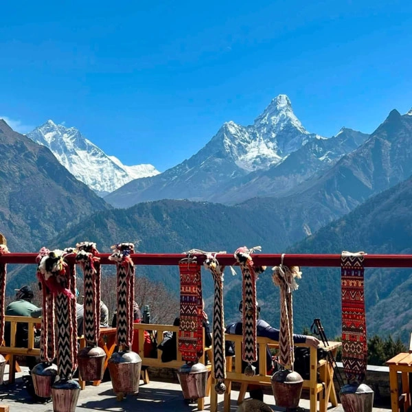
The monastery courtyard also offers one of the best mountain backdrops on the route, with Everest, Lhotse, Nuptse, and Ama Dablam all visible on a clear day. Many trekkers say this view rivals Kala Patthar, just earlier in the trip and with far fewer crowds.
Trekking to Dingboche: Moving Above the Tree Line
From Tengboche, the trail drops to Deboche before climbing again toward Dingboche at 4,410 meters. This is where the landscape changes noticeably. Trees thin out, then disappear almost entirely, replaced by scrubby juniper bushes and eventually bare, rocky ground.
The air feels thinner here, and the temperature drops fast once the sun goes behind the ridgeline. Stone walls separate small barley and potato fields, a sign that people still farm at this altitude despite the short growing season.
Dingboche is a popular spot for a second acclimatization stop, and many trekkers notice their pace slowing here even on flat sections. This is normal. The body needs more oxygen-carrying red blood cells to function well above 4,000 meters, and that adjustment takes time, not effort.
Acclimatization Day 2: Scaling Nangkartshang Peak
The second major acclimatization day usually involves a hike up Nangkartshang Peak, sitting at 5,083 meters above Dingboche. It's a tough climb for a "rest day," but the climb-high-sleep-low principle holds: gaining altitude during the day, even briefly, helps the body adjust before you sleep back down in Dingboche.
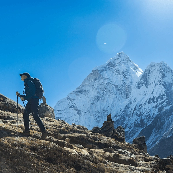
The views from the top are some of the best on the entire trek. Ama Dablam dominates the skyline with its distinctive curved ridges, often compared to a mother's arms (the name literally means "mother's necklace"). Lhotse and Makalu, the fourth and fifth highest peaks in the world, are also visible from here, along with a sweeping view back down the valley you've just climbed through.
Not everyone makes it all the way to the summit, and that's fine. Even reaching the halfway point and turning back still helps with acclimatization. The goal isn't the peak. It's the altitude exposure.
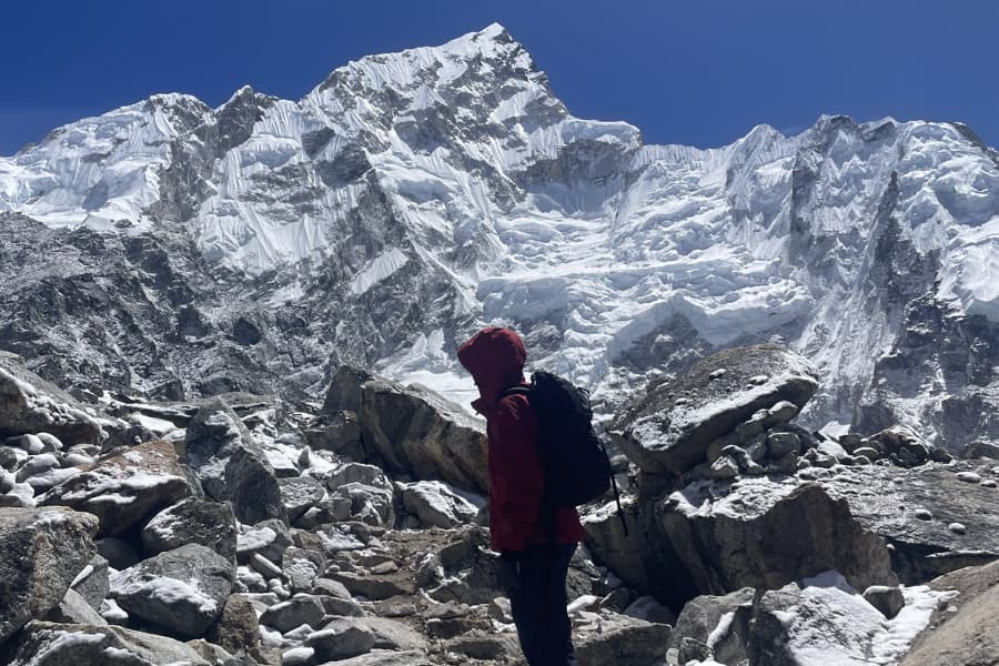
The Walk to Lobuche: Walking Amidst the Giants
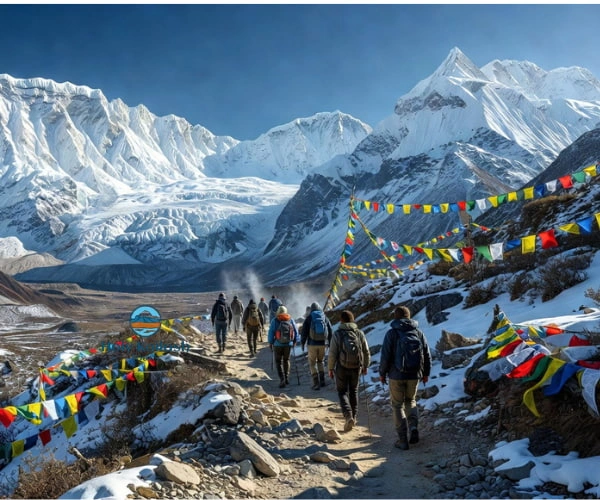
From Dingboche, the trail continues to Thukla before climbing toward Lobuche at 4,940 meters. The terrain here turns rugged and rocky, with the Khumbu Glacier's lateral moraine running alongside much of the path.
This section feels different from anything earlier in the Everest trek. There's no more farmland, no more forest, just stone, ice, and wind. You'll start to see glimpses of the glacier itself, a slow-moving river of ice and rock carved by gravity over thousands of years.
Walking at this altitude takes more out of you than the distance suggests. Even a short, flat stretch can leave you breathing harder than expected. Most guides recommend a slow, steady pace here, sometimes called the "rest step," where you pause briefly between steps to let your breathing catch up.
Thukla Pass: Paying Respect at the Climber's Memorial
Before reaching Lobuche, the trail passes through Thukla, a small collection of teahouses at the base of a steep rocky climb. At the top of this climb sits a memorial site dedicated to climbers and Sherpas who died attempting to summit Everest and the surrounding peaks.
Dozens of stone chortens and plaques line the ridge, many bearing names recognizable to anyone who has read about Everest's mountaineering history. Prayer flags stretch between them, faded by sun and wind.
It's a quiet, sobering stop. Most trekkers walk through slowly, reading names, and the mood on the trail shifts for a while afterwards. It's a reminder that this mountain, for all its beauty, has a long and serious history, and that the people who attempt to climb it take real risks every season.
Approaching Gorak Shep: The Final Settlement
From Lobuche, the trail to Gorak Shep crosses more glacial terrain, weaving along the edge of the Khumbu Glacier with views of Pumori and Khumbutse rising ahead. At 5,164 meters, Gorak Shep is the highest settlement on the standard EBC route and the last place with proper lodges before reaching base camp itself.
The village sits on a flat, sandy plain that was once a lake bed, now dried into pale dust that the wind kicks up constantly. Accommodation here is basic. Rooms are small, walls are thin, and it gets cold fast once the sun drops. Most lodges run on solar power with limited charging access, so it's smart to charge devices and power banks whenever you get the chance at lower elevations.
This is also typically where trekkers split their final push into two parts: a walk to Everest Base Camp itself, followed by an early morning climb to Kala Patthar for sunrise views. Both are demanding at this altitude, so a good night's sleep here matters, even if sleep at 5,164 meters rarely feels restful.
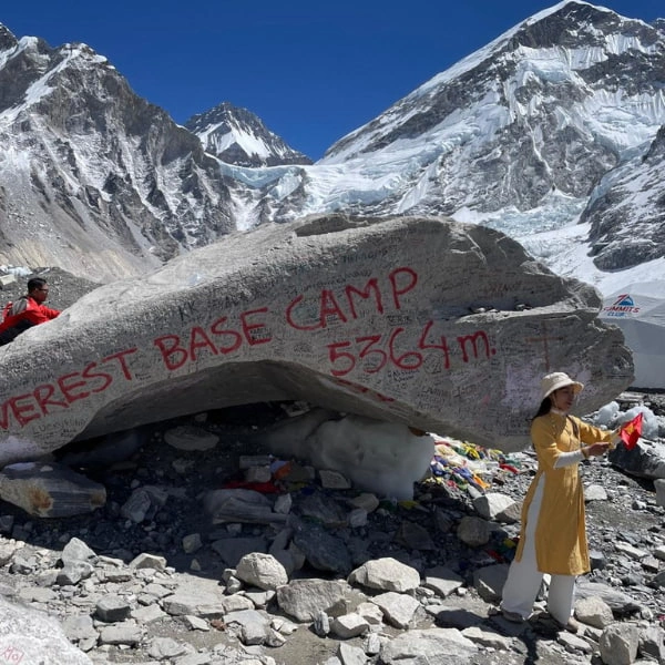
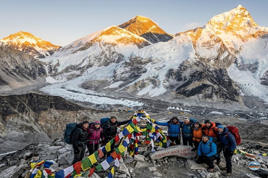
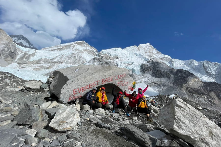
Reaching Everest Base Camp: The Ultimate Goal
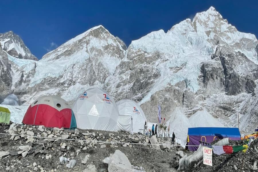
The walk from Gorak Shep to Everest Base Camp takes a few hours over uneven, rocky terrain along the edge of the Khumbu Glacier. There's no dramatic "finish line" here, no sign marking the exact spot in most seasons, just an open expanse of ice, boulders, and the looming wall of the Khumbu Icefall ahead.
During climbing season (typically April and May), base camp fills with colourful expedition tents, and the place buzzes with climbers preparing for summit attempts. Outside of that window, it's quieter, sometimes eerily so, with just the wind and the occasional creak of shifting ice.
Standing at 5,364 meters, looking up at the icefall and knowing Everest's summit sits more than 3,400 meters above you, gives a strange kind of perspective. You can't actually see the summit from base camp itself, since Nuptse blocks the direct view, but that almost doesn't matter. What matters is being here, having walked every step of the way, with your own legs and lungs.
Most trekkers describe a mix of exhaustion, pride, and disbelief at this point. It's common to tear up a little, even among people who don't consider themselves emotional. The walk down to Gorak Shep afterwards feels lighter, in more ways than one.
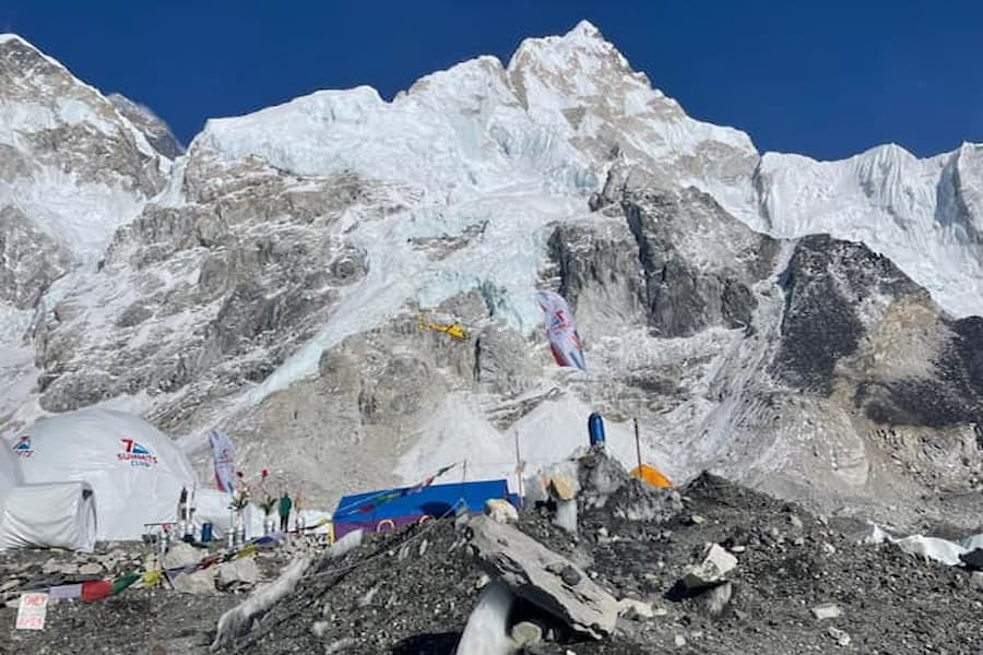
Khumbu Icefall: Witnessing the Glacial Wonder
The Khumbu Icefall stands just above base camp and is one of the most dangerous sections of the entire route to Everest's summit. It forms where the Khumbu Glacier flows over a steep drop, cracking and shifting into massive ice blocks called seracs, some the size of buildings.
The icefall moves constantly, sometimes by several feet a day, which means crevasses open and close, and ice towers collapse without warning. Climbing teams use a network of ladders and ropes through this section, re-fixed each season by the Icefall Doctors, a specialized team of Sherpa guides who maintain the route.
From base camp, you can see parts of the icefall rising in jagged white walls. It's an unsettling kind of beautiful, the sort of thing that makes you understand, in a visceral way, why summiting Everest still claims lives even with modern equipment and weather forecasting.
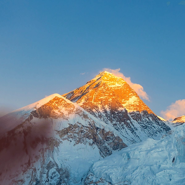
Sunrise at Kala Patthar: The Best Everest Panorama
Kala Patthar, at 5,644 meters, is the highest point most trekkers reach on the EBC route, and it offers the best direct view of Everest's summit on the whole trip. Unlike base camp, where Nuptse blocks the view, Kala Patthar's vantage point puts you face-to-face with Everest's full pyramid shape.
Most groups start this climb in the dark, around 4 or 5 a.m., to reach the summit before sunrise. It's a steep, exhausting climb at this altitude, made tougher by the bitter pre-dawn cold. Headlamps, warm layers, and trekking poles all help.
The reward is worth the discomfort. As the sun rises, it lights up Everest's summit first, turning the peak gold while the valley below stays in shadow. Pumori, Nuptse, Lingtren, and the endless ridgelines of the Khumbu all glow in sequence as the light spreads. Photographers consider this one of the best sunrise shots in the world, and even people who don't usually take photos end up filling their camera roll here.
Descending from the Heights: Returning to Pheriche
After Kala Patthar and base camp, the trek shifts into descent mode, and the body responds almost immediately. Many trekkers notice headaches easing and appetite returning within a day or two of dropping altitude.
The route typically passes back through Lobuche before reaching Pheriche, a village at 4,240 meters known for its Himalayan Rescue Association post, which runs free daily lectures on altitude sickness during peak trekking seasons. It's worth attending if your schedule allows, even at this late stage, since recognizing symptoms in others on the trail can genuinely save a life.
Descending isn't entirely risk-free either. Tired legs on rocky downhill trails lead to slips and twisted ankles more often than people expect. Trekking poles help a lot here, and so does slowing down rather than rushing toward warmer air and better food.
The Long Trek Back: From Namche to Lukla
The final stretch retraces much of the route you walked on the way up, through Tengboche, down to the river crossings, back up to Namche, and finally down to Lukla. It often feels faster than the ascent, partly because the body has adjusted to the altitude changes by now, and partly because the destination feels closer.
There's a noticeable shift in mood these days. Trekkers who were quiet and focused on the way up start talking more, joking with porters and guides, comparing notes on which day was hardest. Namche on the way down feels almost like a different town, livelier somehow, maybe because you know hot showers and proper coffee are close again.
The descent from Namche to Lukla retraces the suspension bridges and riverside trail from day one, but everything looks different with two weeks of perspective behind you. Villages that felt remote on the way up now feel familiar.
Final Thought: Completing Your Himalayan Journey
By the time you land back in Kathmandu, something has usually shifted. Maybe it's just sore legs and a deep need for a real shower. But for most people, it's more than that.
The Everest Base Camp trek isn't really about reaching a specific point on a map. It's about the accumulation of small things: the first glimpse of Everest from the Namche trail, the chanting at Tengboche monastery, the silence at the climbers' memorial, the cold morning light hitting the summit from Kala Patthar. Each day adds a layer, and by the end, the whole experience feels bigger than the sum of its parts.
This trek also tests patience in a way few other trips do. You can't rush altitude. You can't control the weather on the Lukla flight. You learn to adjust, to slow down, and to trust a process that's been refined by generations of Sherpa guides who know this terrain better than anyone.
Holy Kailash Tours has helped trekkers prepare for and complete this exact route, with attention to proper acclimatization scheduling, experienced local guides, and honest advice about what each day actually demands. A good itinerary, paired with the right support on the ground, makes the difference between a trip that wears you down and one that genuinely changes how you see what your body and mind can handle.
Whether you're a first-time trekker or someone who's done a dozen treks before, Everest Base Camp has a way of humbling and rewarding everyone who attempts it. Walk it slowly, respect the altitude, and let the Khumbu show you why this remains one of the most meaningful journeys in the world.
Trip FAQs
1. How many days does the Everest Base Camp trek take?
Most itineraries run 12 to 14 days, including flights, acclimatization days, and the trek itself. Some operators offer shorter or longer versions depending on fitness level and added side trips.
2. What is the highest altitude reached on the EBC trek?
Kala Patthar, at 5,644 meters, is the highest point most trekkers reach. Everest Base Camp itself sits at 5,364 meters.
3. Do I need previous trekking experience for EBC?
No technical climbing skills are required, but a reasonable level of fitness helps a lot. Many first-time trekkers complete EBC successfully with proper preparation and a sensible pace.
4. What is the best season to trek to Everest Base Camp?
Spring (March to May) and autumn (September to November) offer the most stable weather and clearest mountain views. Winter is colder but quieter, and the monsoon season brings rain and limited visibility.
5. How does altitude sickness affect trekkers on this route?
Symptoms like headaches, nausea, and fatigue are common above 3,500 meters. Proper acclimatization days, slow ascent, and good hydration reduce the risk significantly.
6. What kind of accommodation should I expect?
Teahouses along the route offer basic rooms, usually with twin beds, shared bathrooms in most cases, and simple bedding. Rooms get more basic the higher you climb.
7. What food is available during the trek?
Dal bhat (rice, lentils, and vegetables) is the staple, alongside noodle soups, momos, porridge, and basic breakfast items. Prices rise with altitude due to transport costs.
8. Is the Lukla flight safe?
The flight has a strong safety record overall, though weather delays and cancellations are common. Morning flights tend to be more reliable than afternoon ones.
9. Can I trek to EBC without a guide?
Independent trekking is allowed on this route, though hiring a licensed guide adds safety, local knowledge, and support with permits and navigation, especially useful for first-timers.
10. What permits are required for the trek?
You'll need a Sagarmatha National Park entry permit and a local Khumbu Pasanglhamu Rural Municipality entry permit. Most trekking companies arrange these as part of the booking.
11. How much should I budget for the trek daily?
Daily costs for food and lodging typically range from $25 to $40, depending on altitude and choices, not including flights, permits, or guide fees.
12. What should I pack for the EBC trek?
A good down jacket, sturdy trekking boots, layered clothing, a warm sleeping bag, trekking poles, and a basic first aid kit cover the essentials. Many items can be rented in Kathmandu.
13. Is travel insurance necessary for this trek?
Yes, travel insurance covering high-altitude trekking and emergency helicopter evacuation is strongly recommended, given the remote terrain and altitude-related risks.